")
")
Cultural Landscape and Heritage
Trilateral Workshop in Amersfoort, NL, on 18 January 2012:
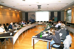
On 18 January 2012, a workshop was held at the Dutch Cultural Heritage Agency in Amersfoort, The Netherlands for a presentation and discussion of the Dutch Indicative Mapping of the Archaeological Values (IKAW) and the applicability of the method and the approach in a marine wide Wadden Sea context. At the workshop participated experts from the LancewadPlan collaboration from Germany and The Netherlands, the Dutch agency and other experts.
The presentations given at the workshop are available as pdf files.
It was agreed at the workshop that the annual LancewadPlan workshop to be held in Schleswig-Holstein in September 2012 should be devoted to the issue with the aim to develop a project for applying the indicative planning for the marine area of the Wadden Sea.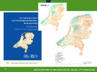 PRESENTATIONS:
1. A short introduction to Dutch archaeology by Mr Jos Bazelmans, Rijksdienst voor het Cultureel Erfgoed
"Mapping the unknown"
2. Predictive modelling and the Dutch Indicative Map of Archaeological Values (IKAW) by Mr Bjorn Smit, Cultural Heritage Agency
"Nationwide predictive modelling as aid to Archaeological Heritage Management"
3. The impact of the Dutch IKAW on archaeology and spatial development by Ms Gerda de Bruin, Rijksdienst voor het Cultureel Erfgoed
"The Dutch IKAW in spatial planning (Why and How?)"
4. Mapping the Holocene coastal development of the Netherlands by Mr Henk Weerts, Cultural Heritage Agency
"Mapping the Holocene coastal development of the Netherlands"
5. Mapping the early modern en modern development of the western Wadden Sea by Mr Menne Kosian, Cultural Heritage Agency
"Now you see it, Now you don’t! Integrating remote-sensing with historical data in changing environments"
6. The known and the unknown: MACHU and the development of a new maritime IKAW by Mr Martijn Manders, Cultural Heritage Agency
"The known and the unknown: MACHU and the development of a new maritime IKAW"
Trilateral Workshop in Husum, D, on 24-26 September 2012:
 On 24-26 September 2012, a workshop on predictive mapping was held at the Kreishaus Husum. The workshop introduced the method of indicative mapping in a maritime context and reflected the development of the Holocene period and the use of the maritime heritage in historic times. On this basis, three main objectives built the umbrella of the workshop:
(1) Acceptance of indicative mapping as an approach and use in conservation, management and spatial planning
(2) Outline of a common project indicative mapping supported by partners
(3) Integration of conservation and heritage approaches
The workshop has reinforced the trans-boundary cooperation on the cultural heritage of the Wadden Sea Region and will probably lead to a common project on indicative mapping in the near future. Workshop Indicative Mapping, draft summary record
PRESENTATIONS:
1. Short introduction Mr. Ulf Ickerodt, Archäologisches Landesamt Schleswig-Holstein
"Workshop Indicative Mapping"
2. Indicative mapping of the Wadden Sea Area - A geological perspective by Mr. Henk Weerts, Cultural Heritage Agency NL and
Ms Martina Karle, NIHK (Lower Saxony Institute for Historical Coastal Research)
"Indicative mapping of the Wadden Sea Area - A geological perspective"
3. The Cultural Sea: Integrating remote-sensing with historical data in changing environments by Mr. Menne Kosian, Cultural Heritage Agency NL "The Cultural Sea: Integrating remote-sensing with historical data in changing environments"
4. Habitation and use of the Wadden Sea from an archaeological perspective by Mr. Martin Segschneider, Archäologisches Landesamt Schleswig-Holstein "Habitation and use of the Wadden Sea from an archaeological perspective"
5. A natural history of the Wadden Sea by Mr. Karsten Reise, AWI-Sylt
"Why a Wadden Sea? Contingency in natural history"